| Nelson Mandela Born: July 18, 1918 Age: 94 years old Birthplace: Transkei, South AfricaOccupation: World Leader, Journalist
On February 11, 1990, Nelson Mandela was freed after 27 years in captivity. “No one is born hating another person because of the color of his skin, or his background, or his religion. People must learn to hate, and if they can learn to hate, they can be taught to love, for love comes more naturally to the human heart than its opposite.” – Nelson Mandela Last year we announced a $1.25 million grant to the Nelson Mandela Centre of Memory to help preserve and digitize thousands of archival documents, photographs and videos about Nelson Mandela. Based in Johannesburg, South Africa, the Nelson Mandela Centre of Memory (NMCM) is committed to documenting the life and times of one of the world’s greatest statesmen and spreading his story to promote social justice throughout the world.
Today, the Mandela archive has become a reality. Along with historians, educationalists, researchers, activists and many others around the world, you can access a wealth of information and knowledge about the life and legacy of this extraordinary African leader. The new online multimedia archive includes Mandela’s correspondence with family, comrades and friends, diaries written during his 27 years of imprisonment, and notes he made while leading the negotiations that ended apartheid in South Africa. The archive will also include the earliest-known photo of Mr. Mandela and never-before seen drafts of Mr. Mandela’s manuscripts for the sequel to his autobiography Long Walk to Freedom.
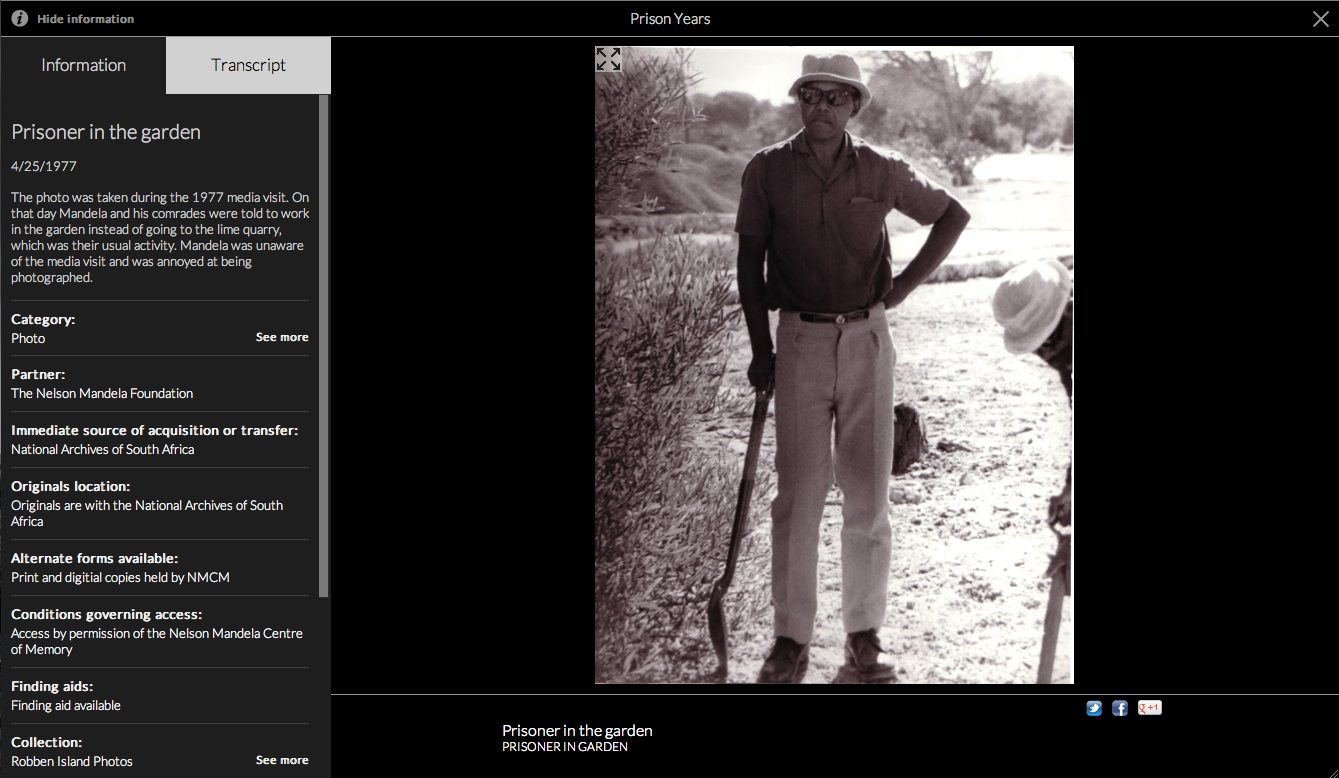 We’ve worked closely with the NMCM to create an interactive online experience which we hope will inspire you as much as us. You can search and browse the archives to explore different parts of Mandela’s life and work in depth: Early Life, Prison Years, Presidential Years, Retirement, Books for Mandela, Young People and My Moments with a Legend.  From there, you might want to see all the letters held by the archive, and click “See more” in the letters category, where you can discover all personal letters or use the time filter to explore his diaries and calendars written between 1988 and 1998, where you can see that in the last page of the last diary, he met with President Yoweri Kaguta Museveni of Uganda to exchange ideas about the situation in northern Uganda. If you were a researcher, you can search through various fragments of Madiba’s memory that relate to Ahmed Kathrada, his long-time comrade, politician and anti-apartheid activist, where you can find photos, videos, manuscripts and letters that relate to him. 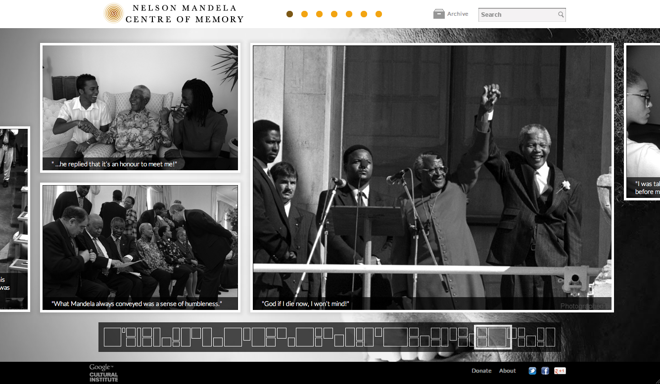 The Nelson Mandela Digital Archive project is an initiative by the Nelson Mandela Centre of Memory and the Google Cultural Institute, which helps to preserve and promote our diverse cultural and historical heritage. Some of our other initiatives include the Art Project, digitizing the Dead Sea Scrolls and bringing the Yad Vashem Holocaust materials online. |
Daily Archives: 02/11/2023

history… February 11

1752 – The Pennsylvania Hospital opened as the very first hospital in America.
1808 – Judge Jesse Fell experimented by burning anthracite coal to keep his house warm. He successfully showed how clean the coal burned and how cheaply it could be used as a heating fuel.
1812 – The term “gerrymandering” had its beginning when the governor of Massachusetts, Elbridge Gerry, signed a redistricting law that favored his party.
1858 – A French girl, Bernadette Soubirous, claimed to have seen a vision of the Virgin Mary near Lourdes.
1878 – The first U.S. bicycle club, Boston Bicycle Club, was formed.
1929 – The Lateran Treaty was signed. Italy now recognized the independence and sovereignty of Vatican City.
1936 – Pumping began the process to build San Francisco’s Treasure Island.
1937 – General Motors agreed to recognize the United Automobile Workers Union, which ended the current sit-down strike against them.
1938 – “The Big Broadcast of 1938” was released.
1940 – NBC radio presented “The Chamber Music Society of Lower Basin Street” for the first time.
1943 – General Dwight David Eisenhower was selected to command the allied armies in Europe.
1945 – During World War II, the Yalta Agreement was signed by U.S. President Franklin Roosevelt, British Prime Minister Winston Churchill and Soviet leader Josef Stalin. (Today in World War II History)
1957 – The NHL Players Association was formed in New York City.
1958 – Ruth Carol Taylor was the first black woman to become a stewardess by making her initial flight.
1960 – Jack Paar walked off while live on the air on the “Tonight Show” with four minutes left. He did this in response to censors cutting out a joke from the show the night before.
1968 – The new 20,000 seat Madison Square Garden officially opened in New York. This was the fourth Garden.
1972 – McGraw-Hill Publishing Co. and Life magazine canceled plans to publish an autobiography of Howard Hughes. The work turned out to be fake.
1975 – Margaret Thatcher became the first woman to head a major party in Britain when she was elected leader of the Conservative Party.
1979 – Nine days after the Ayatollah Ruhollah Khomeini returned to Iran (after 15 years in exile) power was seized by his followers.
1982 – ABC-TV’s presentation of “The Winds of War” concluded. The 18-hour miniseries cost $40 million to produce and was the most-watched television program in history at the time.
1982 – France nationalized five groups of major industries and 39 banks.
1984 – The tenth Space Shuttle mission returned to Earth safely.
1989 – Rev. Barbara C. Harris became the first woman to be consecrated as a bishop in the Episcopal Church.
1990 – Nelson Mandela was freed after 27 years in captivity.
1990 – In Tokyo, Japan, James “Buster” Douglas knocked out Mike Tyson in the tenth round to win the heavyweight championship.
1993 – Janet Reno was appointed to the position of attorney general by U.S. President Clinton. She was the first female to hold the position.
2000 – The space shuttle Endeavor took off. The mission was to gather information for the most detailed map of the earth ever made.
2000 – Great Britain suspended self-rule in Northern Ireland after the Irish Republican Army (IRA) failed to begin decommissioning (disarming) by a February deadline.
2002 – The six stars on NBC’s “Friends” signed a deal for $24 million each for the ninth and final season of the series.
2006 – In Texas, U.S. Vice President Dick Cheney accidentally shot and wounded a companion during a quail hunt.
2016 – It was reported that scientists had detected gravitational waves. The waves had been detected on September 14, 2015 by the Laser Interferometer Gravitational-wave Observatory (LIGO) detectors in Livingston, LA, and Hanford, WA.
on-this-day.com


You must be logged in to post a comment.