
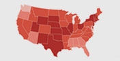
Official Weather Information, Safety tips, Hazard information

Official Weather Information
Hydrologic Outlook issued November 6 at 1:14PM PST by NWS Seattle, WA ESFSEW Another storm system will impact western Washington tonight, with additional rainfall between 2 to 2.75 inches.
Snow levels this evening will be between 6000-7000 feet and will decrease to 3800-4000 feet Friday morning. This combination of heavy rainfall and high snow levels will lead already elevated rivers to rise, potentially above flood stage. While the probability is low, the Snoqualmie River has the greatest chance of minor flooding.
Please monitor the latest river forecasts from the National Weather Service for additional information. © 2025 National Weather Service
Safety tips
Find Safe Shelter
Move to higher ground without delay. Avoid low-lying areas, riverbanks, and streams.
Avoid Floodwaters
Do not walk, swim, or drive through floodwaters. Just six inches of moving water can knock you over, and one foot can carry away your vehicle.
Stay Informed
Keep updated with weather alerts and warnings via a NOAA Weather Radio, local news, or weather apps.
Prepare to Evacuate
Be ready to evacuate if instructed by local authorities. Have an emergency kit with essentials like water, food, medications, and important documents ready.
Secure Your Home
If time permits, move valuable items to higher levels and disconnect electrical appliances.
Avoid Bridges
Stay off bridges over fast-moving water, as they can be hazardous during floods.
Hazard information
Areal Flood
Occurs over a large area due to prolonged periods of moderate to heavy rainfall.
Develop more gradually, often over hours or days.
Flash Flooding
Flash floods develop within 6 hours of the immediate cause, such as heavy rain, ice or debris jams, and levee or dam failure.
Urban areas are especially prone to flash floods due to concrete and asphalt surfaces.
Steep, hilly, or mountainous terrain produces rapid runoff and quick stream response.
River Flooding
River flooding occurs when river levels rise and overflow their banks.
Classified as Minor, Moderate, or Major based on water height and impacts.
Causes include heavy rainfall, dam failures, rapid snowmelt, and ice jams.
Storm Surge and Coastal Inundation
Coastal flooding generally occurs with land-falling or near-land tropical storms or hurricanes.
Storm surge and large waves pose the greatest threat to life and property along the coast.
Tropical cyclones can cause flooding in the U.S. each spring through fall.
Burn Scars/Debris Flows
Burn scars occur in areas where wildfires have burned away vegetation.
Flooding can produce mud and debris flows, destroying homes and infrastructure.
Ice/Debris Jams
Ice jams are common during winter and spring along rivers, streams, and creeks.
Debris jams can occur at any time of year and have similar implications as ice jams.
Snowmelt
Snowmelt flooding occurs when melting snow is the major source of water involved in a flood.
High soil moisture conditions prior to snowmelt can contribute to flooding.
Dry Wash
Significant rainfall in dry areas can quickly cause flooding.
Water from storms rushes to low-lying areas, often into canyons or dried-up river beds.
Dam Breaks/Levee Failure
Dam failure or levee breaches can occur with little warning.
Causes include prolonged rainfall, landslides, earthquakes, erosion, improper maintenance, and sabotage.
*The National Weather Service for additional information. © 2025 National Weather Service


You must be logged in to post a comment.